
There are so many woodlands and trails in London area to explore. Here’s a quick read from London tourism about the natural areas around us Unique Natural Areas found in London Ontario.
For a more complete view, including links to brochures and maps, we have summarized below all the best information we could find about areas where we can hike and explore, get some exercise, enjoy family-friendly fun and learn more about nature.
Woodlands and trails in London area are managed by different groups.
- City of London ESA’s managed by UTRCA
- City of London Parks
- Thames Valley Trail
- Conservation areas – UTRCA, LTRCA
- Provincial Parks
In all cases, please use the official access points, stay on the managed trails, take NO plants, and help keep the areas litter-free.

Canadian wild ginger “Asarum Canadensis”
City of London ESA’s
The City has 11 ESA’s managed by the Upper Thames Conservation area
In the City of London, 21 natural areas are currently designated as “Environmentally Significant Areas” or ESAs. These areas exist within both agricultural and urban settings and include wetlands, forests and meadows as well as river corridors, valleys and significant wildlife habitat. The City funds a contract with the UTRCA to manage 11 of the ESAs and these are accessible to the public for hiking.

Downloadable, printable brochures and maps are available for each area:
- The Coves
- Kains Woods
- Kelly Stanton
- Kilally Meadows
- Lower Dingman Creek
- Meadowlily
- Medway Valley Forest
- Pottersburg Valley
- Sifton Bog
- Warbler Woods
- Westminster Ponds
Pre-printed brochures are also available free of charge from Tourism London Information Centre (696 Wellington Road South), Dundas Street Information Centre (267 Dundas Street at Wellington), Upper Thames River Conservation Authority (519-451-2800 ext 281) and the City of London, City Planning (519-661-4980)
City of London Parks
The City of London is home to over 490 parks, green spaces, sports fields, trails and natural areas. Parks and Recreation staff are responsible for ensuring these green spaces are maintained to City standards, allowing residents to continue to lead healthy, socially active lives.
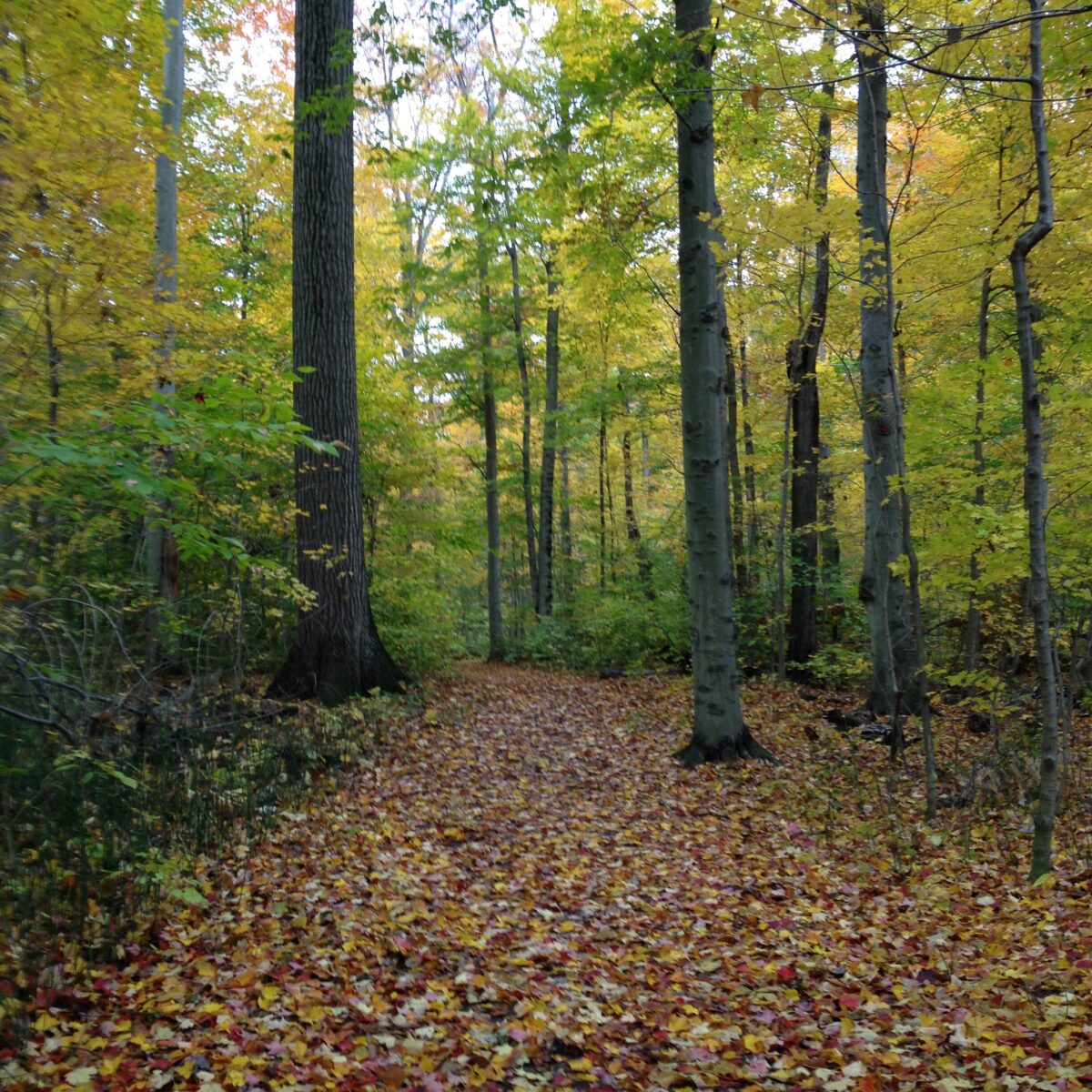
Woodland trail in the fall
- Cancer Survivor Gardens
- City Wide Sports Park
- Civic Garden complex, Elmo Curtis and Rayner Gardens
- Fork of the Thames
- Gibbons
- Greenway
- Harris
- Springbank
- Victoria
Thames Valley Trail
The Thames Valley Trail is a 110 km hiking trail running from Delaware, through London to St. Mary’s. It follows branches of the Thames River along most of the route. This trail links the Elgin Trail at the Elgin/Middlesex County line in the south with the Avon Trail in St. Marys in the north.
CLICK HERE FOR TRAIL MAPS – Portions of these trails are on privately-owned land. Please be respectful!
Through the City of London, the trail follows a multi-use pathway much of the way and continues along the North Thames River. North of London the trail traverses the Fanshawe Conservation Area operated by the Upper Thames River Conservation Authority. The City of London portion is called Thames Valley Parkway, aka TVP. It is 40 kilometres in length, offers scenic river crossings and is linked to over 150 kilometres of additional pathways connecting all corners of London. You can view the TVP network through the City’s interactive CityMap.
Thames Valley Trail Association TVTA – this volunteer group offers organized hikes, updates about trail conditions and camaraderie for hikers for a very low annual membership fee. They also sell an excellent guidebook .
Conservation Areas
We have two in our immediate area namely the Upper Thames and Lower Thames with lots of natural areas, wetlands and trails to explore.
Upper Thames Conservation Area
These natural areas include wetlands, meadows, forests, and valleys that are home to many different plants and wildlife and most are considered environmentally significant.
Fanshawe Conservation Area – Fanshawe Lake trail is 20 km for shared use biking/hiking and Fanshawe Hiking Trails (hiking only) are Tamarack (1.3 km) and Meadows (2.1 km). Day-use fee applies. TRAIL MAP
Wildwood Conservation Area has three trails that range in length from 1.2 km to 24 km and all can be used by both hikers and cyclists. These trails explore Dr R.S. Murray Forest, which is home to many species of birds and mammals. Wildwood Lake Trail (24 km) level of difficulty is considered easy to moderate, but its length makes it a challenge! Day-Use Fee applies. TRAIL MAP
Pittock Lake Conservation Area – Woodstock has two trails to hike or bike. The Husky Trail (5 km) is a wide, flat, loop trail that can be accessed at campground Section 4. A day-use entry fee applies. The South Shore Trail is a longer trail with some looping side trails. A portion within Roth Park is paved. There is no fee to access this trail. TRAIL MAP
Lower Thames Conservation Authority
These locations offer opportunities for hiking, birding, picnicking, snowshoeing and cross-country skiing.
- Longwoods Road Conservation Area / Ska-Nah Doht Village & Museum
- Big O Conservation Area
- C.M. Wilson Conservation Area
- E.M. Warwick Conservation Area
- McGeachy Pond Conservation Area
- Sharon Creek Conservation Area
- Sinclair’s Bush
- Two Creeks Conservation Area
- Walter Devereux Conservation Area
- Merlin Conservation Area
- Big Bend Conservation Area
- Rowsom’s Tilbury West Conservation Area
- Mill Stream Conservation Area
- Mosa Forest / Skunk’s Misery
Provincial Parks
- Komoka Provincial Park is the closest provincial park to London. It is accessed via a pay-to-park lot at 503 Gideon Drive, just west of Byron. It offers numerous trails for hikers and birders Trail Map 1 and Trail Map 2.
- The Pinery Provincial Park at Grand Bend is worth the drive and the day-use fee. This excellent year-round outdoor recreation area boasts 21 square kilometres of rare forests and rolling dunes. Enjoy 10 walking trails, a 14 km bike trail and 38 km of groomed ski trails. You can also rent a canoe, hydro bike, paddleboat or a single or double kayak to explore the Old Ausable Channel which is a provincially significant wetland. Pinery Park Trails.
There are so many great woodlands and trails in London and surrounding areas for exercise, fresh air and observation of native plants, trees, birds and wildlife and while you’re there, take time to sit and relax too.
Please respect our natural areas and help keep them beautiful.
TIPS for Hiking and Exploring woodlands and trails in London area
Bring along your binoculars and nature guidebooks of local birds and wildflowers. Looking for the best smartphone apps? Check our recommendations here.
Use bug spray and wear long pants tucked into your socks to reduce the chance of ticks and disease. Here’s more from MLHU about ticks and lime disease:
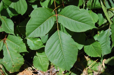
Avoid wandering off the trails as you’ll be certain to encounter poison ivy. Toronto Master Gardeners shared this excellent post about identifying and dealing with poison ivy.
More
Here’s an excellent new blog post from Everywhere Ontario “10 most beautiful trails in London”






About The Author: Armstrong
As an author and editor, Linda directs her lifelong love of nature and plants to concerns about our environment and how we can do better. In addition to decades of gardening experience, and training as a master gardener, Linda focuses on learning from leading science-based educators and writers, and in the process finds that she uncovers many gardening myths.
More posts by Armstrong